
3 Essential Drone Images For Waterfront Properties
Drone images are widely used in real estate photography today, regardless of the property type. Waterfront properties specifically benefit from the aerial perspective that drones offer though.
In this article I’ll share 3 essential drone images for waterfront properties and briefly discuss why drones are necessary to photography homes on the water.
Table of Contents
Why Drone Images are Necessary for Waterfront Properties
Drones offer a unique perspective that ground photography simply cannot match, providing potential buyers with a comprehensive view of the property and its surroundings.
If you don’t yet have a drone or are wondering if your drone is up to the task in terms of image quality, you can check out our article Best Drones for Real Estate Photography.
This aerial vantage point is especially beneficial for showcasing waterfront properties, where the proximity to water is a significant selling point.
This aerial perspective allows buyers to appreciate the layout of the property, the expanse of the shoreline, and the beauty of the surrounding landscape.
By highlighting features such as private docks, beach access, or the seamless integration of indoor and outdoor living spaces with the water, drones tell a compelling story of waterfront living.
For many buyers, the appeal of a waterfront property lies in the recreational opportunities it offers. Drones can effectively showcase proximity to water activities such as boating, fishing, swimming, and kayaking.
Aerial footage can illustrate how easily these activities can be accessed from the property, enhancing its appeal to lifestyle-oriented buyers.
From Over the Water, Looking Back Towards the Property
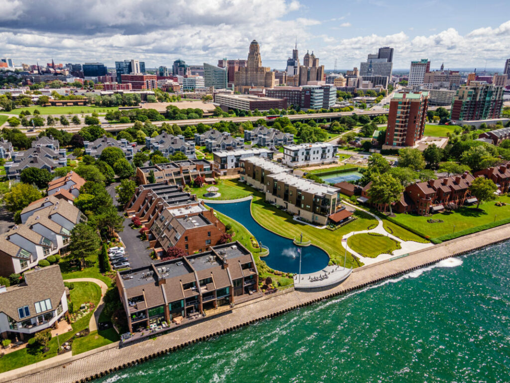
There is a certain joy that I get every time I fly my drone way out over the water and look back at the property I’m photographing.
It always makes for a great image and would be impossible if I didn’t have my drone with me. Unless you’re going to charter helicopter or plane I guess.
But the image looking back at the property from over the water isn’t just fun to capture, it tells a great story for the property.
You see the home from out over the water, a perspective that no potential buyer has likely seen before. It shows where the home is in relation to the water, but more importantly, it shows where the property is in relation to the rest of the city or surrounding area.
It paints the full picture of what’s included in the lifestyle of the property. In the image above, the image shows a waterfront property located in a downtown setting.
Looking Out Towards The Water
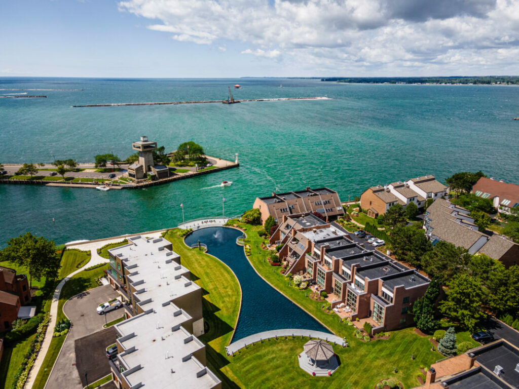
Looking out towards the water is always an iconic photo for every water front property. This perspective allows the viewer to see the expansive water that the property sits on.
Unlike the image where you fly your drone over the water and look back at the property, this image looking towards the water offers no context in terms of where the property sits in relations to the area around it.
This perspective is a bit more dreamy since it shows mostly water. It paints a picture of possibility since living on the waterfront can provide such a water-centric lifestyle.
This is the view that any boat owner, water sport enthusiast, nature lover, or person that just finds the water captivating wants to see most.
Far many potential buyers, this drone image sums up the entire reason they want to purchase the property in the first place. It’s easy to capture and very much worth the photo.
From Directly Overhead
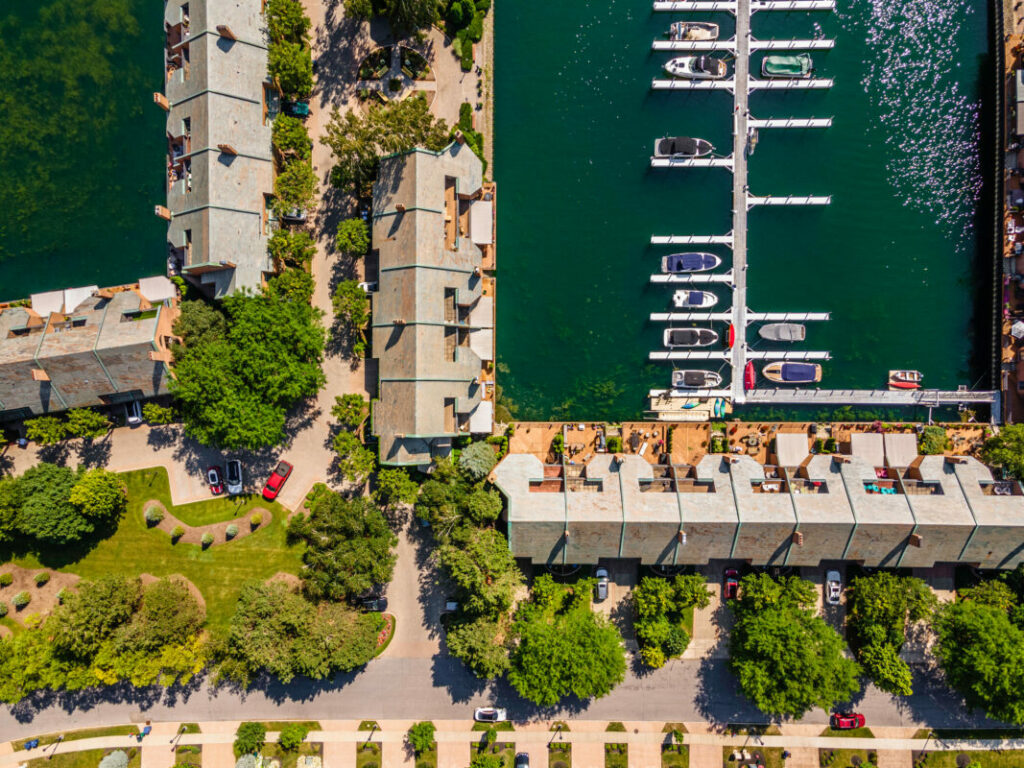
The directly overhead image is one that’s captured at most properties to show the entire property lot and the condition of the roof.
As you can see from the image above though, it offers a completely different purpose when the property is located directly on the water.
This high up, overhead shot where the drone is pointed directly down shows the exact distance the the property is from the water, as well as how the property lot interacts with the water and the surrounding area.
Additional Resources
Flying drones along a waterfront is always fun, but waterfronts can come with drastic and fast changes in the weather which make flying not always the safest activity.
Give our article When is the Weather too Bad to Fly a Drone a read for a full understanding of the do’s and don’ts of flying in dicey weather.
If you’re just getting started in real estate photography, check out our Beginners Guide. It’s full of helpful articles and tips that will guide you in the right direction as you begin your real estate photography journey.
You can check out our Gear section as well to see reviews and recommendations on the latest real estate photography gear.
If you’re more interested in other resources that can help your real estate photography business, check out our Business Resources page.